File:DSD Bridge over Cheyenne River.jpg
Jump to navigation
Jump to search
Size of this preview: 763 × 600 pixels. Other resolutions: 305 × 240 pixels | 611 × 480 pixels | 977 × 768 pixels | 1,280 × 1,006 pixels | 2,560 × 2,013 pixels | 4,672 × 3,673 pixels.
Original file (4,672 × 3,673 pixels, file size: 1.95 MB, MIME type: image/jpeg)
|
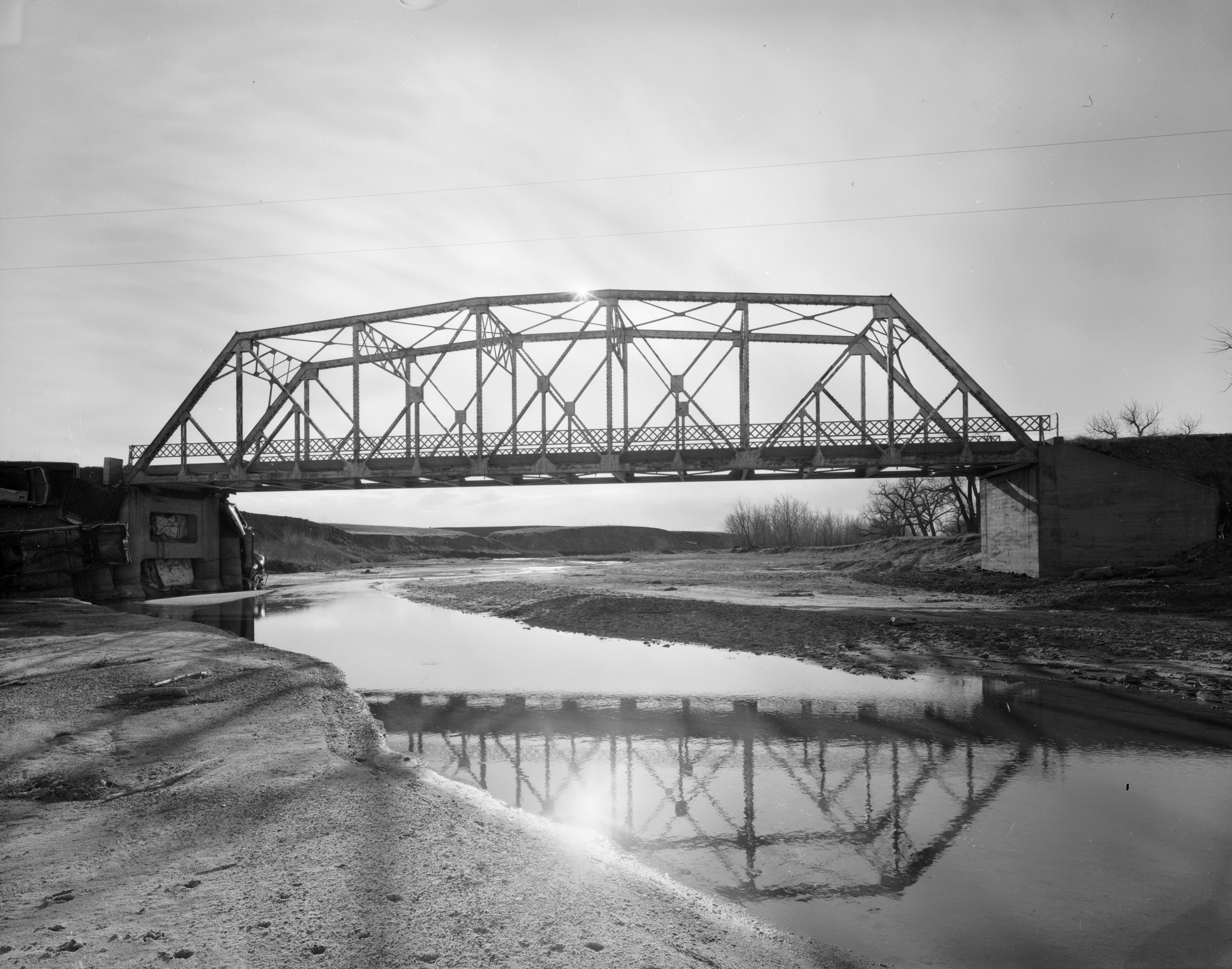
This is an image of a place or building that is listed on the National Register of Historic Places in the United States of America. Its reference number is 85000429. |
| Camera location | | View this and other nearby images on: OpenStreetMap |
|---|
| Description |
English: Western side of the DSD Bridge over Cheyenne River, which carries County Road CN14-46 over the Cheyenne River near Riverview in Niobrara County, Wyoming, United States. Built in 1915, this Pennsylvania through truss bridge is the only one of its subtype still in use in Wyoming, and it is listed on the National Register of Historic Places. |
||||
| Date | |||||
| Source |
Library of Congress, Prints and Photograph Division HAER: WYO,14-RIVEW.V,1-1
|
||||
| Author | Clayton B. Fraser | ||||
| Permission (Reusing this file) |
|

File history
Click on a date/time to view the file as it appeared at that time.
| Date/Time | Thumbnail | Dimensions | User | Comment | |
|---|---|---|---|---|---|
| current | 16:05, 27 April 2009 | | 4,672 × 3,673 (1.95 MB) | commons>Martin H. | high res; cropped |
File usage
There are no pages that use this file.