File:DMIR Map.png
Jump to navigation
Jump to search
Size of this preview: 744 × 600 pixels. Other resolutions: 298 × 240 pixels | 596 × 480 pixels | 953 × 768 pixels | 1,082 × 872 pixels.
Original file (1,082 × 872 pixels, file size: 17 KB, MIME type: image/png)
File history
Click on a date/time to view the file as it appeared at that time.
| Date/Time | Thumbnail | Dimensions | User | Comment | |
|---|---|---|---|---|---|
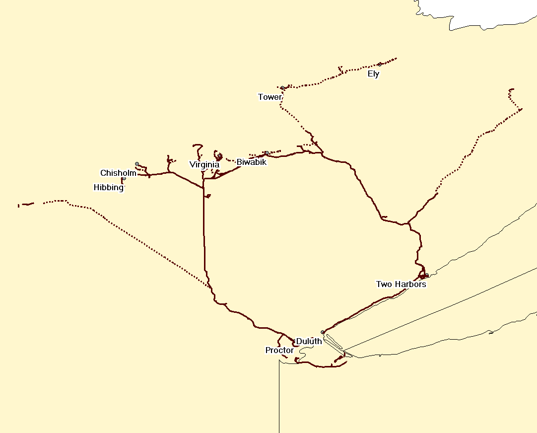
| current | 15:40, 1 January 2009 | | 1,082 × 872 (17 KB) | commons>手練~commonswiki | {{Information |Description={{en|Map of the en:Duluth, Missabe and Iron Range Railway. Solid lines are tracks still in use; dotted lines are abandoned. The section from Two Harbors to Duluth is effectively operated by the [[:en:North Shore Scenic Rai |
File usage
There are no pages that use this file.