File:Conquista Hispania.svg
Jump to navigation
Jump to search

Size of this PNG preview of this SVG file: 800 × 547 pixels. Other resolutions: 320 × 219 pixels | 640 × 438 pixels | 1,024 × 701 pixels | 1,280 × 876 pixels | 2,560 × 1,752 pixels | 950 × 650 pixels.
Original file (SVG file, nominally 950 × 650 pixels, file size: 1.07 MB)
File history
Click on a date/time to view the file as it appeared at that time.
| Date/Time | Thumbnail | Dimensions | User | Comment | |
|---|---|---|---|---|---|
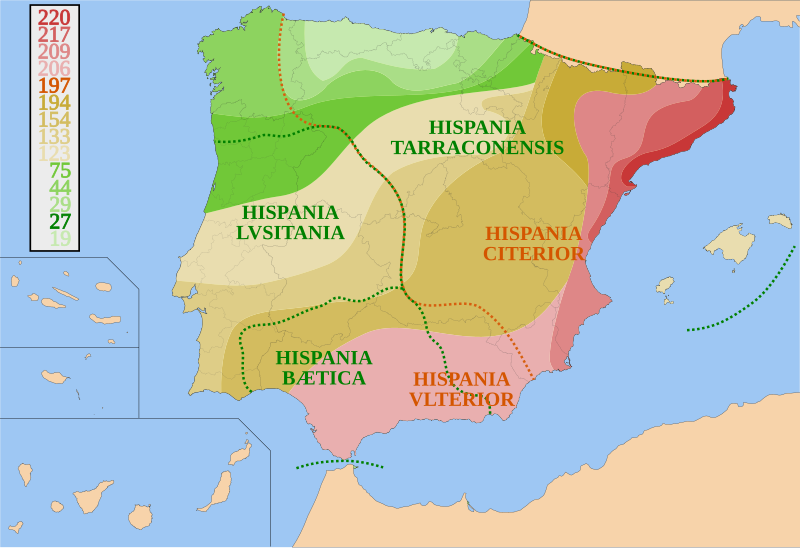
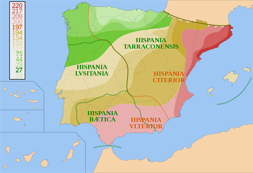
| current | 19:46, 31 July 2007 | | 950 × 650 (1.07 MB) | commons>HansenBCN | {{Information |Description= {{es|Mapa de España y Portugal sobre la conquista de Hispania desde 220 AEC a 19 AEC y sus fronteras provinciales.}} |Source=self-made |Date= July 31, 2007 |Author= HansenBCN }} [[Category:Maps of Roman Hisp |
File usage
There are no pages that use this file.