File:Collón Curá Formation.jpg
Jump to navigation
Jump to search

Size of this preview: 473 × 599 pixels. Other resolutions: 189 × 240 pixels | 379 × 480 pixels | 606 × 768 pixels | 808 × 1,024 pixels | 1,617 × 2,048 pixels | 4,554 × 5,768 pixels.
Original file (4,554 × 5,768 pixels, file size: 5.69 MB, MIME type: image/jpeg)
File history
Click on a date/time to view the file as it appeared at that time.
| Date/Time | Thumbnail | Dimensions | User | Comment | |
|---|---|---|---|---|---|
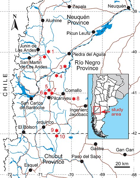
| current | 17:52, 31 May 2022 | | 4,554 × 5,768 (5.69 MB) | commons>FunkMonk | |Description=Map showing localities with outcrops of the Collón Curá Formation. 1, Estancia Collón Curá; 2, Collón Curá River; 3, Cañadón del Tordillo; 4, Cerro Castillo; 5, Estancia El Criado; 6, Pichileufú River; 7, Cerro San Antonio; 8, Comallo; 9, Chico River (Río Negro Province); 10, Chico River (Chubut Province). |Source=https://www.app.pan.pl/article/item/app003732017.html |Date=2017 |Author=Bárbara Vera, Marcelo Reguero, and Laureano González-Ruiz |Permission={{cc-by-2.0}} This image... |
File usage
There are no pages that use this file.