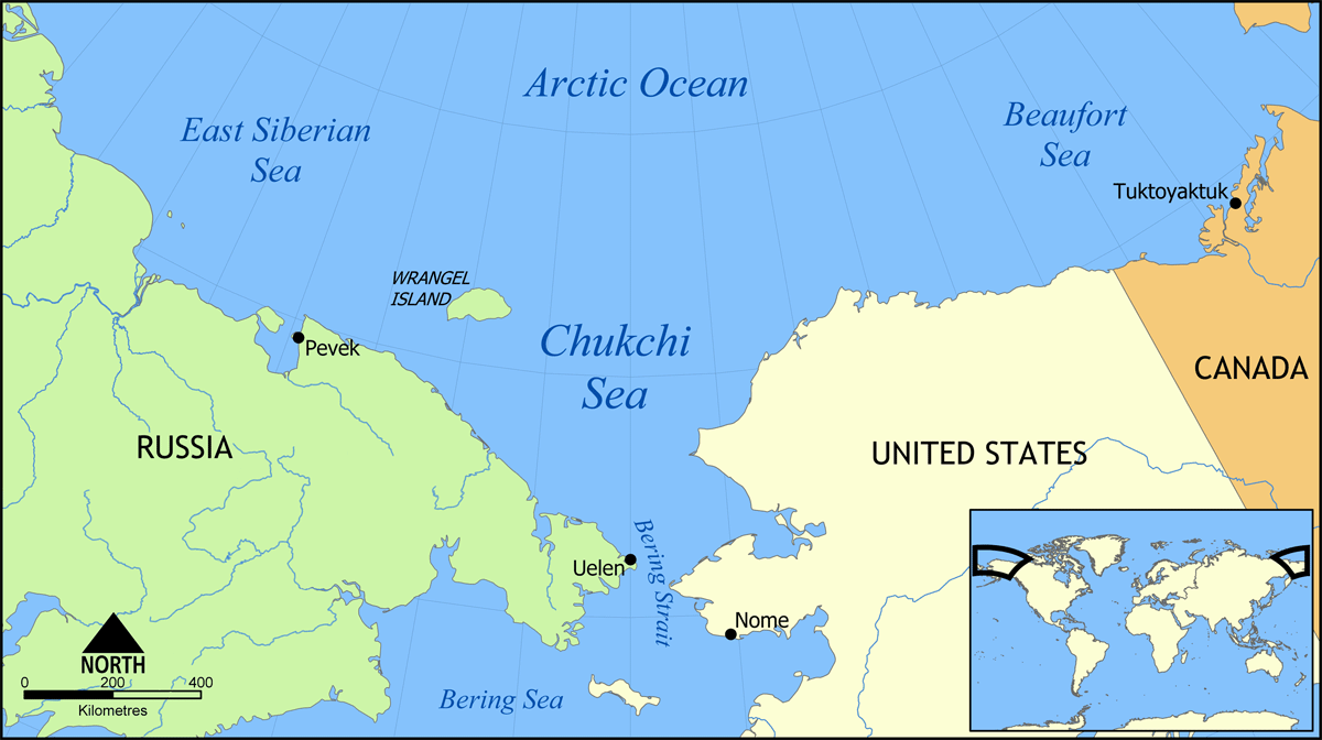
File:Chukchi Sea map.png
Jump to navigation
Jump to search
Size of this preview: 800 × 448 pixels. Other resolutions: 320 × 179 pixels | 640 × 358 pixels | 1,200 × 672 pixels.
Original file (1,200 × 672 pixels, file size: 100 KB, MIME type: image/png)
File history
Click on a date/time to view the file as it appeared at that time.
| Date/Time | Thumbnail | Dimensions | User | Comment | |
|---|---|---|---|---|---|
| current | 14:33, 31 May 2006 | | 1,200 × 672 (100 KB) | commons>NormanEinstein | Map showing the Chukchi Sea, north of the Bering Strait and Sea, between Russia and the United States. Created by NormanEinstein, May 31, 2006. {{GFDL-self}} Category:Maps of seas |
File usage
There are no pages that use this file.