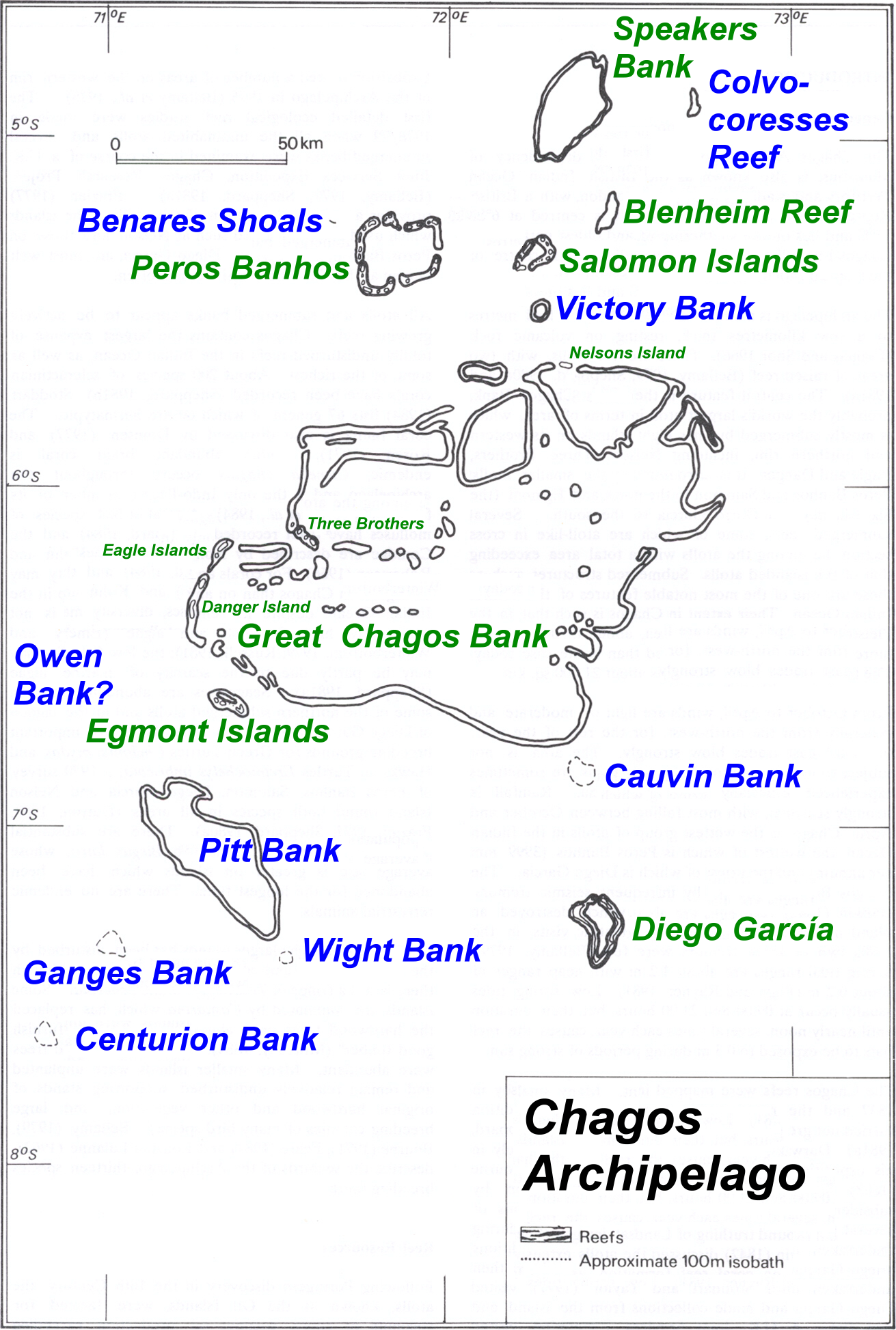
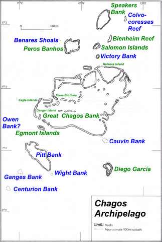
File:Chagos large.png
Jump to navigation
Jump to search
Size of this preview: 404 × 600 pixels. Other resolutions: 161 × 240 pixels | 323 × 480 pixels | 517 × 768 pixels | 689 × 1,024 pixels | 1,311 × 1,947 pixels.
Original file (1,311 × 1,947 pixels, file size: 1.28 MB, MIME type: image/png)
File history
Click on a date/time to view the file as it appeared at that time.
| Date/Time | Thumbnail | Dimensions | User | Comment | |
|---|---|---|---|---|---|
| current | 08:43, 14 March 2008 | | 1,311 × 1,947 (1.28 MB) | commons>Telim tor | == Summary == {{Information |Description=Map of Chagos-Archipelago in the Indian Ocean. |Source=taken from http://www.coral.noaa.gov/reef_maps/volume2/chagos_large.jpg plus atoll and island names completed and rewritten |Date= |Author=NOAA |Permission= |o |
File usage
There are no pages that use this file.