File:Cape Dezhnev USCGS 1937.PNG
Jump to navigation
Jump to search
Size of this preview: 800 × 350 pixels. Other resolutions: 320 × 140 pixels | 816 × 357 pixels.
Original file (816 × 357 pixels, file size: 567 KB, MIME type: image/png)
File history
Click on a date/time to view the file as it appeared at that time.
| Date/Time | Thumbnail | Dimensions | User | Comment | |
|---|---|---|---|---|---|
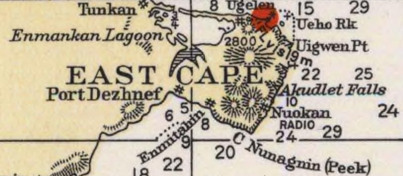
| current | 00:20, 21 December 2009 | | 816 × 357 (567 KB) | commons>Dankarl | {{Information |Description={{en|1=Detail of 1937 USCGS Bering Sea ahowing Cape Dezhnev aka East Cape with geographical features and villages marked. }} |Source=Historical Maps and Charts Project, Office of Coast Survey, US NOAA Bering Sea Chart 9302 6_19 |
File usage
There are no pages that use this file.