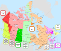
File:Canada time zone map - en.svg
Jump to navigation
Jump to search

Size of this PNG preview of this SVG file: 709 × 600 pixels. Other resolutions: 284 × 240 pixels | 568 × 480 pixels | 908 × 768 pixels | 1,211 × 1,024 pixels | 2,422 × 2,048 pixels | 1,114 × 942 pixels.
Original file (SVG file, nominally 1,114 × 942 pixels, file size: 383 KB)
File history
Click on a date/time to view the file as it appeared at that time.
| Date/Time | Thumbnail | Dimensions | User | Comment | |
|---|---|---|---|---|---|
| current | 03:56, 31 October 2020 |  | 1,114 × 942 (383 KB) | commons>MapGrid | Converted small area of fishing camps west of Suomi ON from CST/CDT to EST/EDT; this improves alignment with boundaries shown on the official Ontario road map. Also applied a few cosmetic changes. |
File usage
There are no pages that use this file.