File:California map showing Santa Clara County.png
Jump to navigation
Jump to search
No higher resolution available.
California_map_showing_Santa_Clara_County.png (200 × 231 pixels, file size: 28 KB, MIME type: image/png)
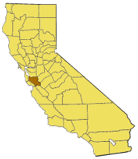
| Description | ==Replacement for California map showing Santa Clara County== |
| Date | (UTC) |
| Source | |
| Author |
|
| This is a retouched picture, which means that it has been digitally altered from its original version. Modifications: Highlighted Santa Clara County, scaled and converted to png. The original can be viewed here: California map showing counties (source).xcf:
|
This work is in the public domain in the United States because it is a work prepared by an officer or employee of the United States Government as part of that person’s official duties under the terms of Title 17, Chapter 1, Section 105 of the US Code.
Note: This only applies to original works of the Federal Government and not to the work of any individual U.S. state, territory, commonwealth, county, municipality, or any other subdivision. This template also does not apply to postage stamp designs published by the United States Postal Service since 1978. (See § 313.6(C)(1) of Compendium of U.S. Copyright Office Practices). It also does not apply to certain US coins; see The US Mint Terms of Use.
|
 | |
| This file has been identified as being free of known restrictions under copyright law, including all related and neighboring rights. | ||
Original upload log
This image is a derivative work of the following images:
- File:California_map_showing_counties_(source).xcf licensed with PD-USGov
- 2009-02-15T22:45:05Z Papa November 0x0 (371861 Bytes) == Summary == Base image for the [[list of California counties|California county]] maps ([[GIMP]] image). Based on the [http://meta.wikipedia.com/upload/California_Map.jpg modified Commerce Dept map] used in [[California]].
Uploaded with derivativeFX
File history
Click on a date/time to view the file as it appeared at that time.
| Date/Time | Thumbnail | Dimensions | User | Comment | |
|---|---|---|---|---|---|
| current | 02:21, 18 August 2009 | | 200 × 231 (28 KB) | commons>Droll | {{Information |Description===Replacement for California map showing Santa Clara County== |Source=*File:California_map_showing_counties_(source).xcf |Date=2009-08-18 02:15 (UTC) |Author=*File:California_map_showing_counties_(source).xcf: w:User |
File usage
There are no pages that use this file.