File:CL Pacific islands.PNG
Jump to navigation
Jump to search
No higher resolution available.
CL_Pacific_islands.PNG (350 × 350 pixels, file size: 4 KB, MIME type: image/png)
Summary
| Description |
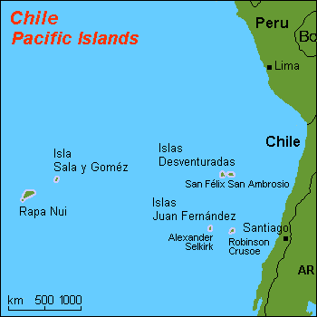
English: Map (rough) of some Chilean islands in the Pacific ocean, own work composed from various mapreferences |
| Date | |
| Source | Own work |
| Author | Hobe / Holger Behr |
| Other versions |
Derivative works of this file: |
Licensing
| I, the copyright holder of this work, release this work into the public domain. This applies worldwide. In some countries this may not be legally possible; if so: I grant anyone the right to use this work for any purpose, without any conditions, unless such conditions are required by law. |
File history
Click on a date/time to view the file as it appeared at that time.
| Date/Time | Thumbnail | Dimensions | User | Comment | |
|---|---|---|---|---|---|
| current | 23:55, 30 May 2008 | | 350 × 350 (4 KB) | commons>Keysanger | == Summary == {{Information |Description=map of some Chilean islands in the Pacific ocean |Source=self-made |Date=2007-09-09 |Author= Hobe modified by Createaccount Category:Maps of Chile }} == Licensing == {{PD-self}} |
File usage
There are no pages that use this file.