File:C85120s1 Ant.Map Wisconsin Range.jpg
Jump to navigation
Jump to search
Size of this preview: 712 × 600 pixels. Other resolutions: 285 × 240 pixels | 570 × 480 pixels | 912 × 768 pixels | 1,215 × 1,024 pixels | 2,431 × 2,048 pixels | 3,844 × 3,239 pixels.
Original file (3,844 × 3,239 pixels, file size: 1.58 MB, MIME type: image/jpeg)
Summary
| Description |
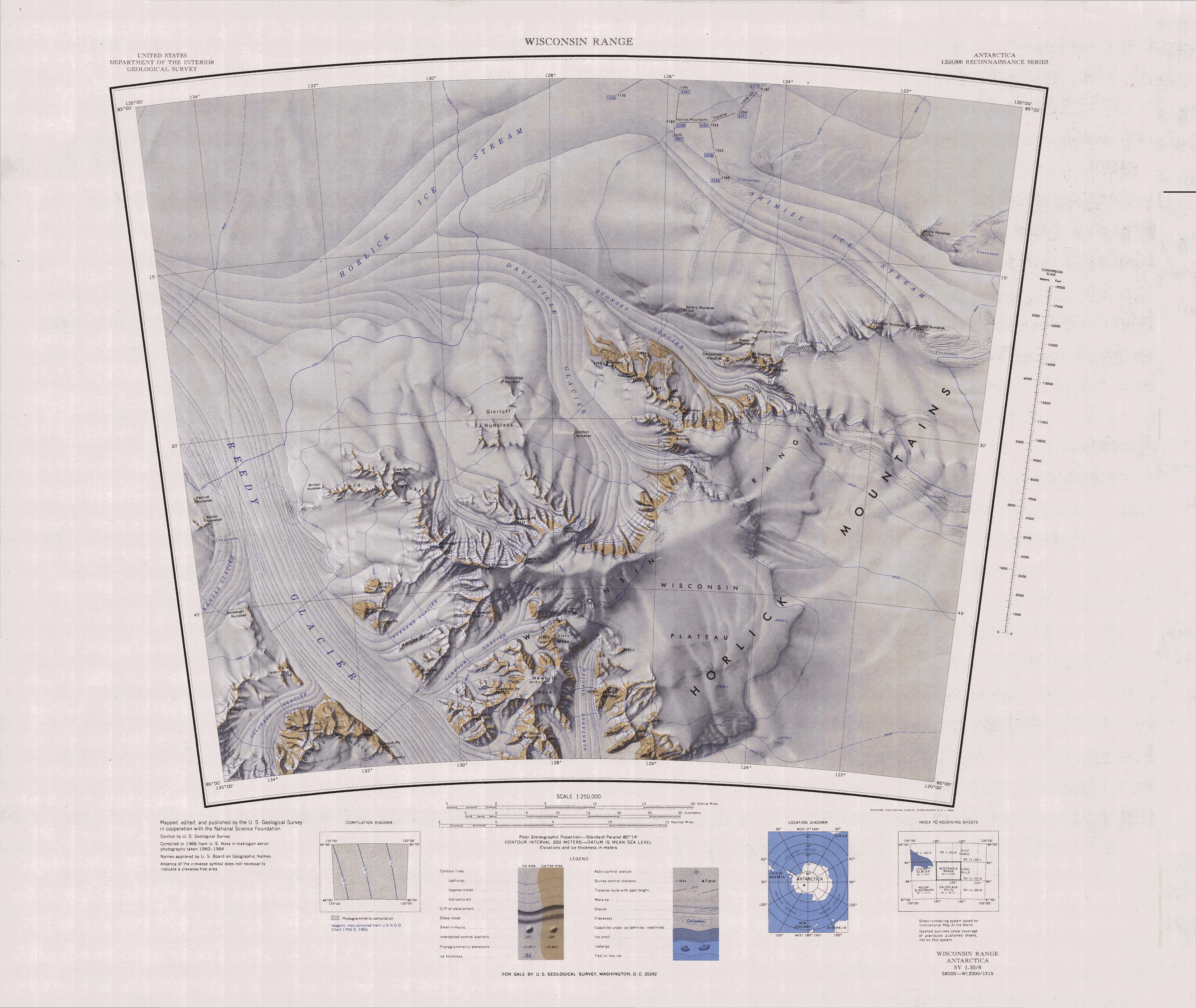
English: 1:250,000-scale topographic reconnaissance map of the Wisconsin Range area from 120°-135°W to 85°-86°S in Antarctica, including the Ready Glacier. Mapped, edited and published by the U.S. Geological Survey in cooperation with the National Science Foundation. |
|||
| Date | ||||
| Source | http://usarc.usgs.gov/drg_dload.shtml | |||
| Author | United States Geological Survey | |||
| Permission (Reusing this file) |
|
File history
Click on a date/time to view the file as it appeared at that time.
| Date/Time | Thumbnail | Dimensions | User | Comment | |
|---|---|---|---|---|---|
| current | 07:41, 21 September 2015 | | 3,844 × 3,239 (1.58 MB) | commons>4ing | == {{int:filedesc}} == {{Information |description={{en|1=1:250,000-scale topographic reconnaissance map of the Wisconsin Range area from 120°-135°E to 85°-86°S in Antarctica, including the Ready Glacier. Mapped, edited and published by the U.S. Geo... |
File usage
There are no pages that use this file.