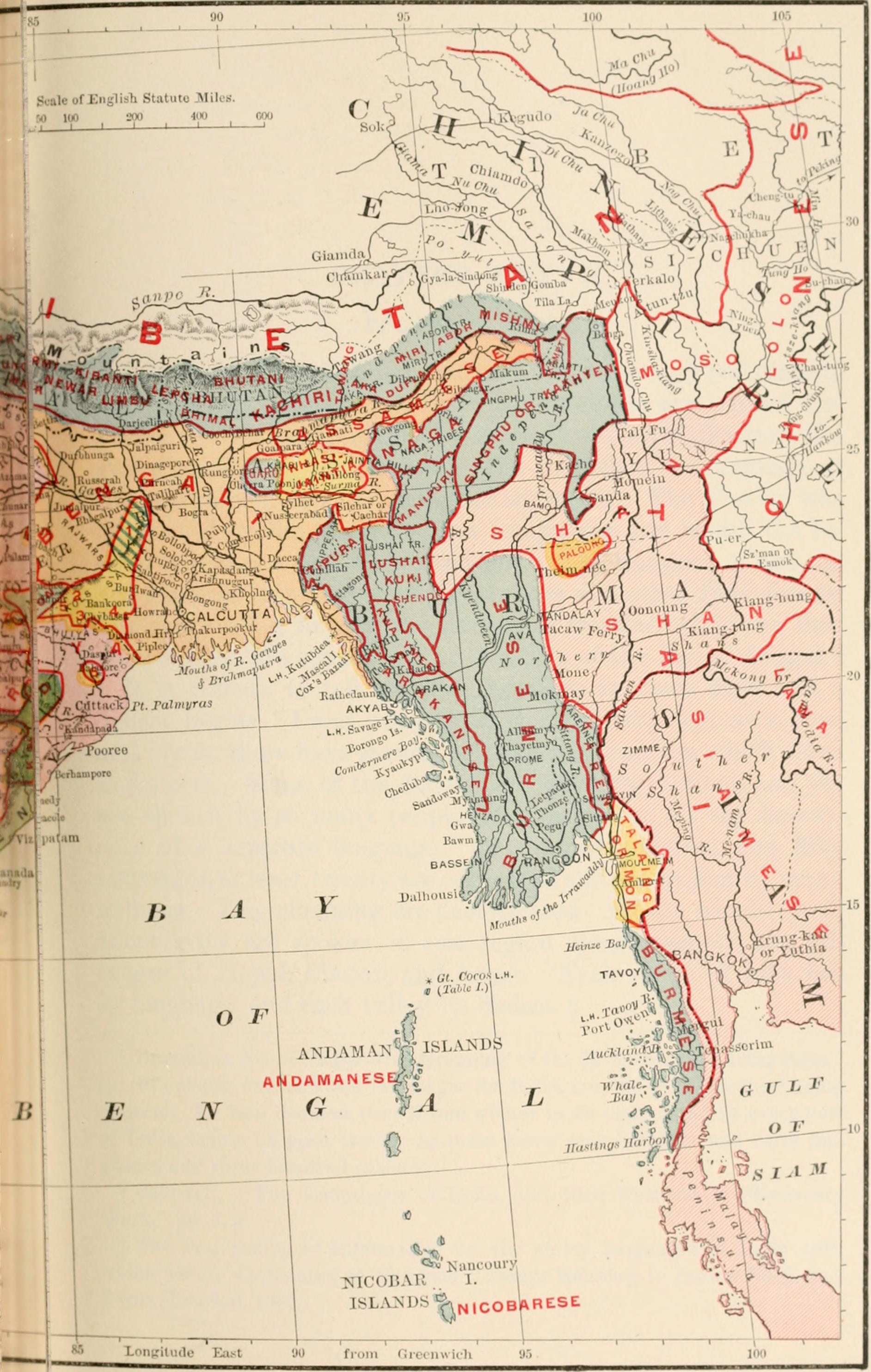
File:British India map of Northeast India and Myanmar, Bengal Assam Meghalaya Arunachal Pradesh Nagaland Manipur Mizoram Tripura regions 1891.jpg
Jump to navigation
Jump to search
Size of this preview: 381 × 600 pixels. Other resolutions: 152 × 240 pixels | 305 × 480 pixels | 488 × 768 pixels | 650 × 1,024 pixels | 1,884 × 2,966 pixels.
Original file (1,884 × 2,966 pixels, file size: 630 KB, MIME type: image/jpeg)
File history
Click on a date/time to view the file as it appeared at that time.
| Date/Time | Thumbnail | Dimensions | User | Comment | |
|---|---|---|---|---|---|
| current | 22:44, 2 August 2014 | | 1,884 × 2,966 (630 KB) | commons>AmyNorth | Transferred from Flickr via Flickr2commons |
File usage
There are no pages that use this file.