File:Bridge abutment at Ingles Ferry.jpg
Jump to navigation
Jump to search

Size of this preview: 800 × 532 pixels. Other resolutions: 320 × 213 pixels | 640 × 426 pixels | 1,024 × 681 pixels | 1,280 × 851 pixels | 2,560 × 1,702 pixels | 6,016 × 4,000 pixels.
Original file (6,016 × 4,000 pixels, file size: 6.36 MB, MIME type: image/jpeg)
| Camera location | | View this and other nearby images on: OpenStreetMap |
|---|
| Description |
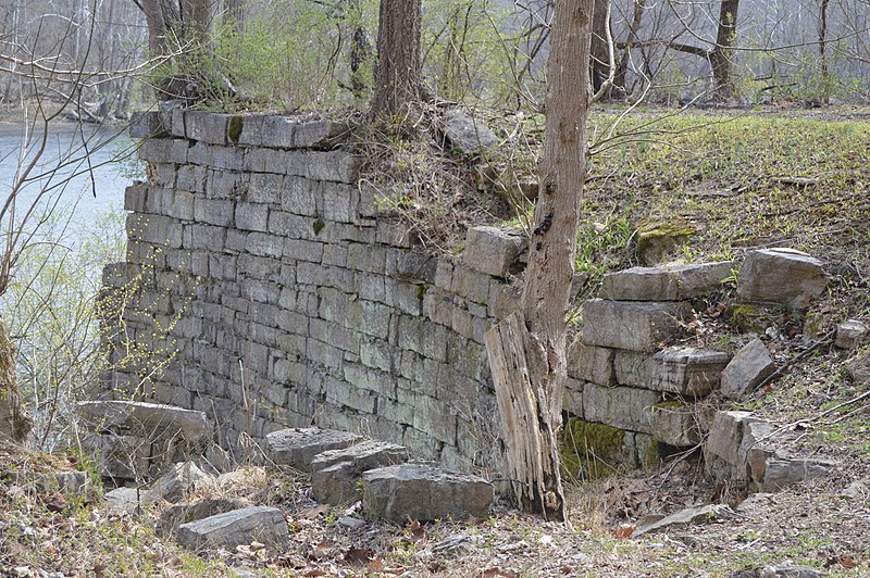
English: An abutment for a destroyed bridge at the site of Ingles Ferry, the spot where the Wilderness Road formerly crossed the New River across from Radford in Pulaski County, Virginia, United States. |
||
| Date | Taken on 25 March 2017 | ||
| Source | Own work | ||
| Author | Nyttend | ||
| Permission (Reusing this file) |
|
File history
Click on a date/time to view the file as it appeared at that time.
| Date/Time | Thumbnail | Dimensions | User | Comment | |
|---|---|---|---|---|---|
| current | 13:09, 29 March 2017 | | 6,016 × 4,000 (6.36 MB) | commons>Nyttend | {{Location|37|6|1|N|80|35|24|W}} {{Information |Description={{en|An abutment for a destroyed bridge at the site of {{w|Ingles Ferry}}, the spot where the Wilderness Road formerly crossed the {{w|New River (Kanawha River)|New River}} across from {{w|Rad... |
File usage
There are no pages that use this file.