File:Blue Ridge Parkway - schematic.jpg
Jump to navigation
Jump to search
Size of this preview: 800 × 537 pixels. Other resolutions: 320 × 215 pixels | 640 × 430 pixels | 1,024 × 687 pixels | 1,280 × 859 pixels | 2,560 × 1,718 pixels | 6,615 × 4,440 pixels.
Original file (6,615 × 4,440 pixels, file size: 2.97 MB, MIME type: image/jpeg)
File history
Click on a date/time to view the file as it appeared at that time.
| Date/Time | Thumbnail | Dimensions | User | Comment | |
|---|---|---|---|---|---|
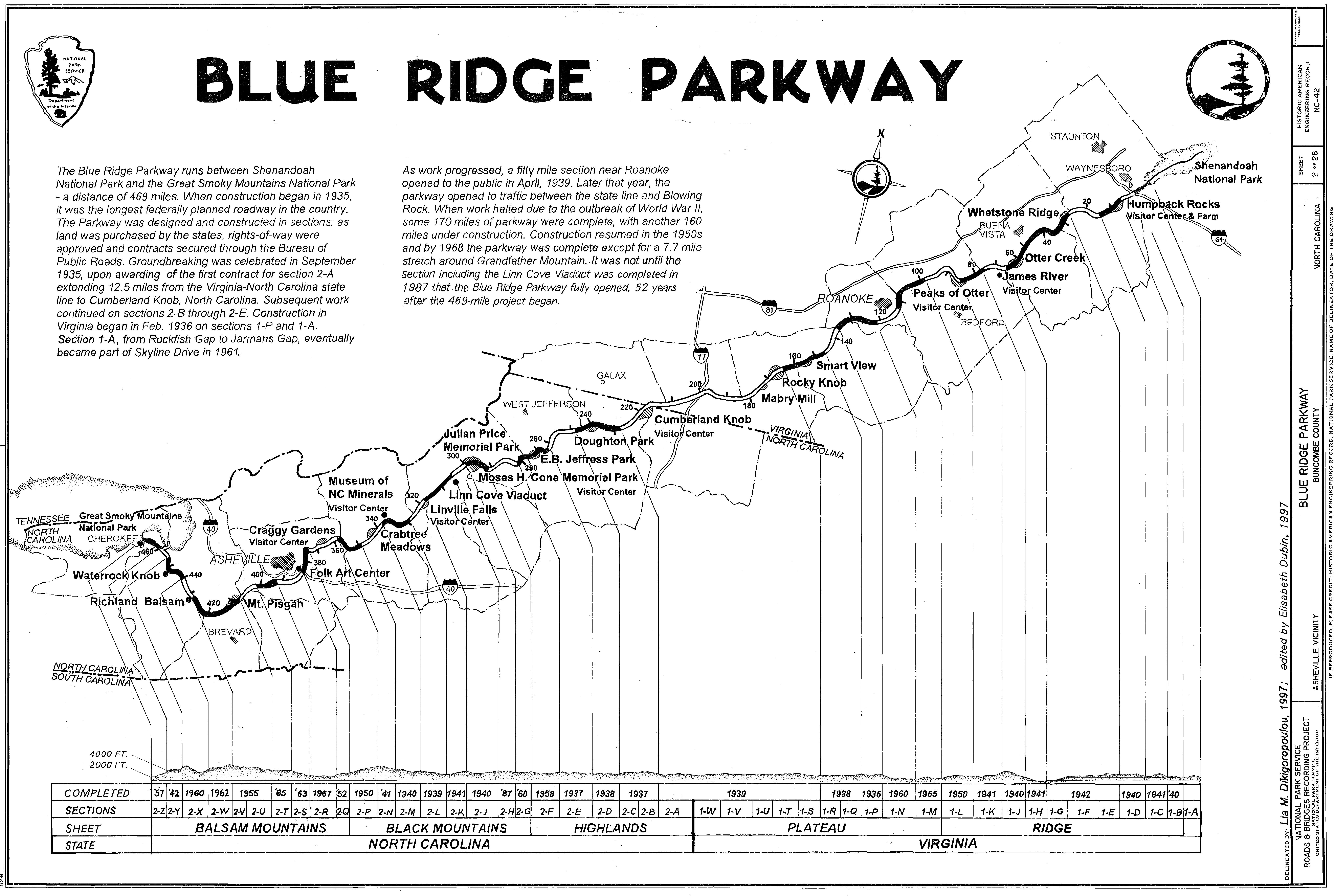
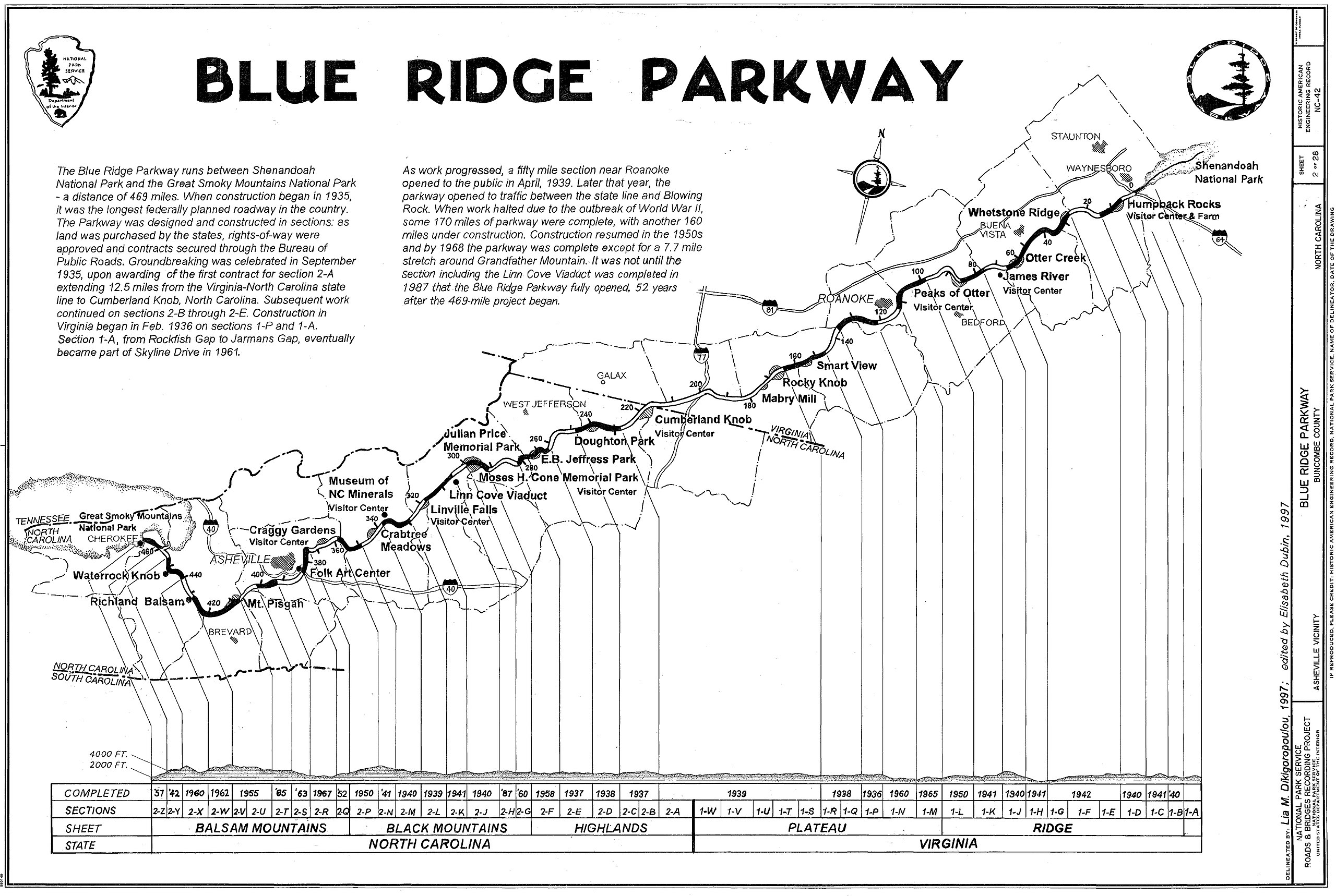
| current | 20:07, 8 December 2007 | | 6,615 × 4,440 (2.97 MB) | commons>AEMoreira042281 | {{Information |Description={{en|Blue Ridge Parkway, Virginia and North Carolina, USA - route schematic with elevations and points of interest. This map was drawn in 1997. It is in the public domain because it was produced by the United States Government. |
File usage
There are no pages that use this file.