File:BaugnezCrossroads1.JPG
Original file (1,614 × 919 pixels, file size: 523 KB, MIME type: image/jpeg)
Summary
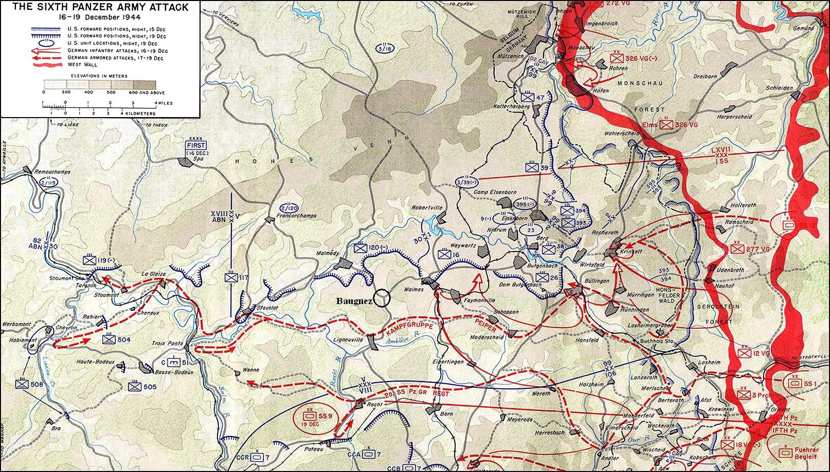
Carte montrant le parcours du "Kampfgruppe Peiper" au cours de la bataille des Ardennes et l'emplacement exact du carrefour de Baugnez.
Le document initial provient de l'ouvrage suivant: UNITED STATES ARMY IN WORLD WAR II, The European Theater of Operations, THE ARDENNES: BATTLE OF THE BULGE, by Hugh M. Cole - OFFICE OF THE CHIEF OF MILITARY HISTORY, DEPARTMENT OF THE ARMY, WASHINGTON, D.C., 1965 pp. 75 et suiv. – [1], qui se trouve sous licence:
![[1]](http://www.army.mil/cmh-pg/books/wwii/7-8/notes/MapII.jpg)
Il a été modifié par mes soins le 7 avril 2007 pour montrer l'emplacement précis du carrefour de Baugnez où a eu lieu le massacre de prisonniers de guerre américains par une unité de la Waffen-SS.
Licensing
This file is a work of a U.S. Army soldier or employee, taken or made as part of that person's official duties. As a work of the U.S. federal government, it is in the public domain in the United States.
|
 |
File history
Click on a date/time to view the file as it appeared at that time.
| Date/Time | Thumbnail | Dimensions | User | Comment | |
|---|---|---|---|---|---|
| current | 09:27, 2 May 2007 | | 1,614 × 919 (523 KB) | commons>Walké |
File usage
There are no pages that use this file.