File:Bassin versant de la Tallapoosa.jpg
Jump to navigation
Jump to search
Size of this preview: 495 × 600 pixels. Other resolutions: 198 × 240 pixels | 396 × 480 pixels | 937 × 1,135 pixels.
Original file (937 × 1,135 pixels, file size: 218 KB, MIME type: image/jpeg)
Summary
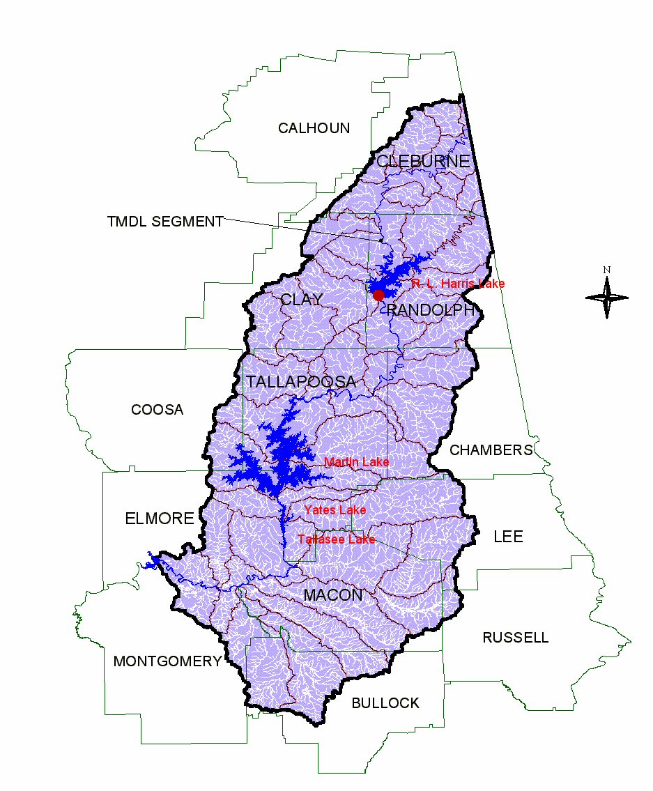
| Description | Bassin versant de la Tallapoosa | ||
| Date | |||
| Source | Wk en http://en.wikipedia.org/wiki/Image:Tallapoosa_River_Drainage_Alabama_1.jpg | ||
| Author | Alabama Department of Environmental Management | ||
| Permission (Reusing this file) |
PD-USGov | ||
| Other versions |
|


Licensing
| This file is licensed under the Creative Commons Attribution-Share Alike 3.0 Unported license. Subject to disclaimers. | ||
| ||
| This licensing tag was added to this file as part of the GFDL licensing update. |

|
Permission is granted to copy, distribute and/or modify this document under the terms of the GNU Free Documentation License, Version 1.2 or any later version published by the Free Software Foundation; with no Invariant Sections, no Front-Cover Texts, and no Back-Cover Texts. A copy of the license is included in the section entitled GNU Free Documentation License. Subject to disclaimers. |
Original upload log
The original description page was here. All following user names refer to en.wikipedia.
- 2007-04-16 18:36 Mike Cline 937×1135×8 (223314 bytes) Image extracted from Public government document: Alabama Department of Environmental Management: Final TMDL Development for Tallapoosa River, AL/Tallapoosa R_1 Low Dissolved Oxygen/Organic Loading, A;abama Department of Water Quality. Annotated with Impo
File history
Click on a date/time to view the file as it appeared at that time.
| Date/Time | Thumbnail | Dimensions | User | Comment | |
|---|---|---|---|---|---|
| current | 09:13, 18 April 2007 | | 937 × 1,135 (218 KB) | commons>Antonov14~commonswiki | {{Information |Description=Bassin versant de la Tallapoosa |Source=Wk en http://en.wikipedia.org/wiki/Image:Tallapoosa_River_Drainage_Alabama_1.jpg |Date=2004 |Author=Alabama Department of Environmental Management |Permission=PD-USGov |other_versions= }} |
File usage
There are no pages that use this file.