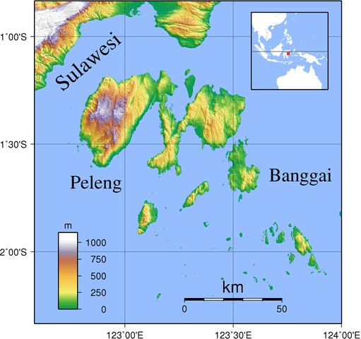
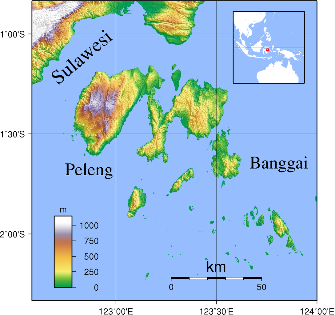
File:Banggai Islands Topography.png
Jump to navigation
Jump to search

Size of this preview: 638 × 600 pixels. Other resolutions: 255 × 240 pixels | 511 × 480 pixels | 817 × 768 pixels | 1,089 × 1,024 pixels | 1,999 × 1,879 pixels.
Original file (1,999 × 1,879 pixels, file size: 1.25 MB, MIME type: image/png)
File history
Click on a date/time to view the file as it appeared at that time.
| Date/Time | Thumbnail | Dimensions | User | Comment | |
|---|---|---|---|---|---|
| current | 21:17, 11 September 2007 | | 1,999 × 1,879 (1.25 MB) | commons>Sadalmelik | {{Information |Description=Topographic map of Banggai Islands, Indonesia. Created with GMT from SRTM data. The coastline data is pretty bad here, but since SRTM data of the region has a lot of spurious land masses, I had to use it nevertheless. |Source=s |
File usage
There are no pages that use this file.