File:Banat Josephinische Landaufnahme pg013.jpg
Jump to navigation
Jump to search

Size of this preview: 800 × 537 pixels. Other resolutions: 320 × 215 pixels | 640 × 429 pixels | 1,024 × 687 pixels | 1,280 × 859 pixels | 2,560 × 1,718 pixels | 8,497 × 5,702 pixels.
Original file (8,497 × 5,702 pixels, file size: 24.46 MB, MIME type: image/jpeg)
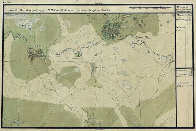
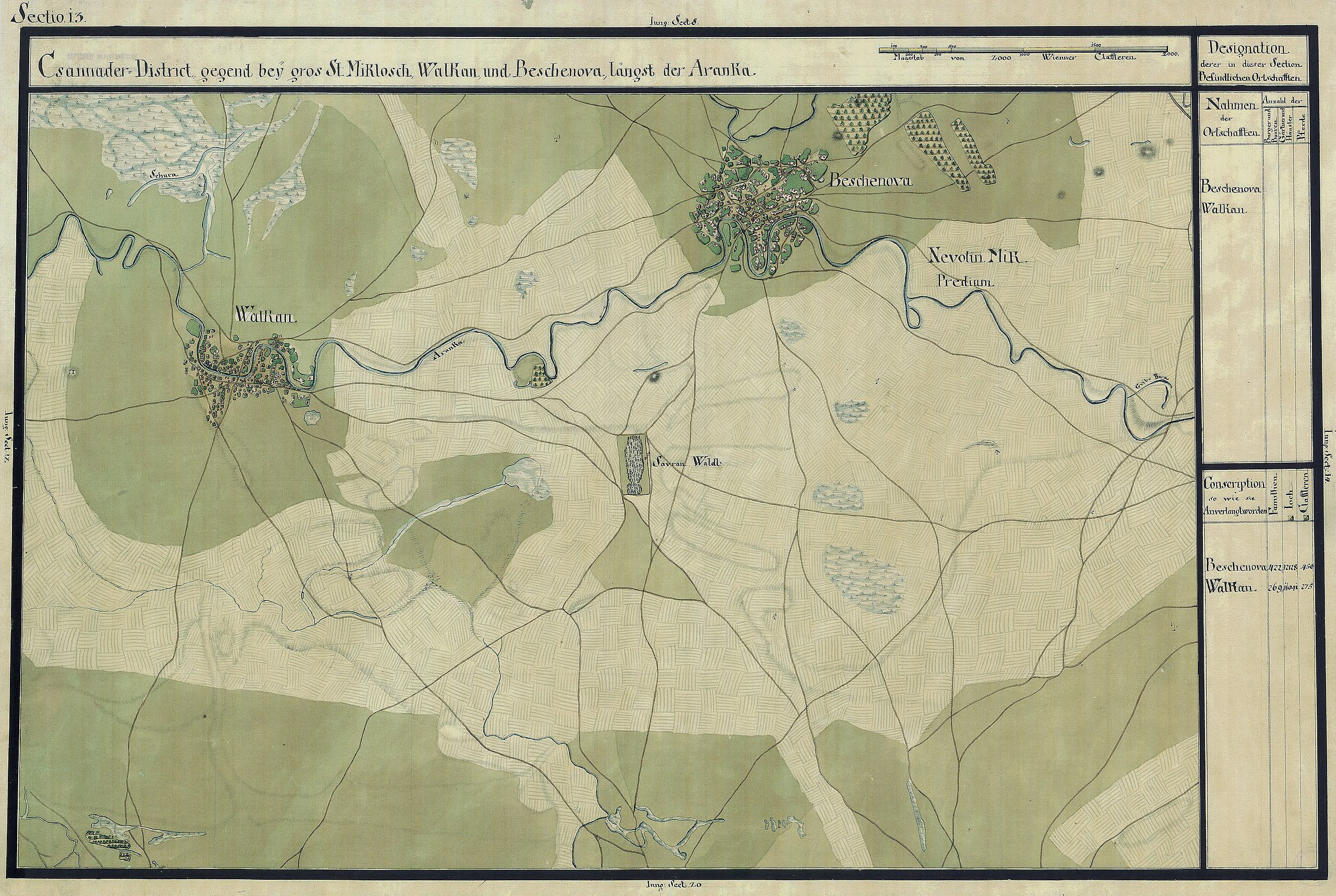
| Name shown on the map Nume din hartă |
Administrative unit Unitate administrativă |
Romanian name Numele românesc |
Hungarian name Numele unguresc |
German name Numele german |
Serbian name Numele sârbesc |
Country today Ţara de astăzi |
|---|---|---|---|---|---|---|
| Beschenova | Csanád kerület Districtul Cenad |
Dudeştii Vechi | Nagybesenyő, BottalütőbesenyőÓbesenyõ | Altbeschenowa (Neu Beschenowa) |
Старо Бешеново | Románia |
| Walkan | Csanád kerület | Vălcani | Valkány | Валкани | Romania |
Summary
| Description |
Deutsch: Das Banat in: Josephinische Landesaufnahme, 1769-72. Josephinische Landaufnahme pg013 English: The Banat region in the cadastral maps: Josephinische Landesaufnahme, 1769-72. Josephinische Landaufnahme pg013 |
||||
| Date | between 1769 and 1772 | ||||
| Source | Österreichisches Staatsarchiv, Kriegsarchiv | ||||
| Author | Historische Militärkarte der österreichisch-ungarischen Monarchie | ||||
| Permission (Reusing this file) |
|
||||
Clickable map of the Banat region

File history
Click on a date/time to view the file as it appeared at that time.
| Date/Time | Thumbnail | Dimensions | User | Comment | |
|---|---|---|---|---|---|
| current | 07:35, 2 January 2010 | | 8,497 × 5,702 (24.46 MB) | commons>Asybaris01 | new rez |
File usage
There are no pages that use this file.