File:Ballast Point Map 1851.jpg
Jump to navigation
Jump to search
No higher resolution available.
Ballast_Point_Map_1851.jpg (334 × 363 pixels, file size: 47 KB, MIME type: image/jpeg)
File history
Click on a date/time to view the file as it appeared at that time.
| Date/Time | Thumbnail | Dimensions | User | Comment | |
|---|---|---|---|---|---|
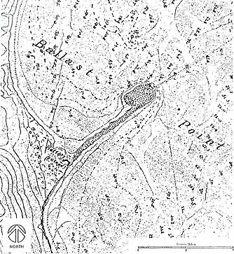
| current | 23:38, 2 March 2008 | | 334 × 363 (47 KB) | commons>Johntex~commonswiki | {{Information |Description=Map of Ballast Point and Fort Guijarros, near present-day San Diego, California, 1851. Caption at source reads, "San Diego Bay, California. “Battery (ruined)”; Enlarged detail of the tracing on the plan table sheet of t |
File usage
There are no pages that use this file.