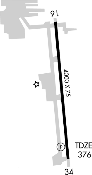
File:Bakersfield Municipal Airport diagram.png
Jump to navigation
Jump to search

Size of this preview: 315 × 599 pixels. Other resolutions: 126 × 240 pixels | 444 × 844 pixels.
Original file (444 × 844 pixels, file size: 42 KB, MIME type: image/png)
File history
Click on a date/time to view the file as it appeared at that time.
| Date/Time | Thumbnail | Dimensions | User | Comment | |
|---|---|---|---|---|---|
| current | 19:14, 14 December 2006 | | 444 × 844 (42 KB) | commons>Epolk | {{Information |Description=Airport diagram of Bakersfield Municipal Airport in Bakersfield, California |Source=http://www.naco.faa.gov/ |Date=December 13, 2006 |Author=Federal Aviation Administration |Permission=Work of the FAA - Public Domain |other_vers |
File usage
There are no pages that use this file.