File:AssamProvince1936 Map.png
Jump to navigation
Jump to search
Size of this preview: 582 × 599 pixels. Other resolutions: 233 × 240 pixels | 466 × 480 pixels | 746 × 768 pixels | 994 × 1,024 pixels | 2,000 × 2,060 pixels.
Original file (2,000 × 2,060 pixels, file size: 519 KB, MIME type: image/png)
Summary
| Description |
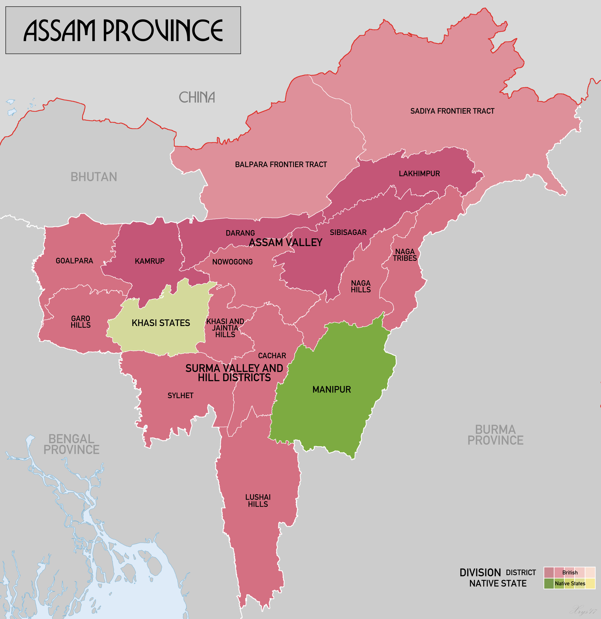
English: Map of Assam Province in 1936, Source data: Survey of India 1:253k (Perry-Castenada Map Library, Univ of Texas), India 1:1M, Imperial Gazetteer of India 1:4M (Digital South Asia Library, Univ of Chicago). Manipur was a princely state supervised by the Governor of Assam. Tripura, another princely state with a similar status, is not shown. |
| Date | |
| Source | Own work |
| Author | XrysD |
Licensing
I, the copyright holder of this work, hereby publish it under the following license:
This file is licensed under the Creative Commons Attribution-Share Alike 4.0 International license.
- You are free:
- to share – to copy, distribute and transmit the work
- to remix – to adapt the work
- Under the following conditions:
- attribution – You must give appropriate credit, provide a link to the license, and indicate if changes were made. You may do so in any reasonable manner, but not in any way that suggests the licensor endorses you or your use.
- share alike – If you remix, transform, or build upon the material, you must distribute your contributions under the same or compatible license as the original.
File history
Click on a date/time to view the file as it appeared at that time.
| Date/Time | Thumbnail | Dimensions | User | Comment | |
|---|---|---|---|---|---|
| current | 15:39, 25 November 2017 | | 2,000 × 2,060 (519 KB) | commons>XrysD | User created page with UploadWizard |
File usage
There are no pages that use this file.