File:Armathwaite Castle - geograph.org.uk - 2708747.jpg
Jump to navigation
Jump to search

Size of this preview: 800 × 516 pixels. Other resolutions: 320 × 206 pixels | 640 × 413 pixels | 1,024 × 661 pixels | 1,280 × 826 pixels | 2,560 × 1,652 pixels | 3,853 × 2,486 pixels.
Original file (3,853 × 2,486 pixels, file size: 1.69 MB, MIME type: image/jpeg)
Summary
| Description |
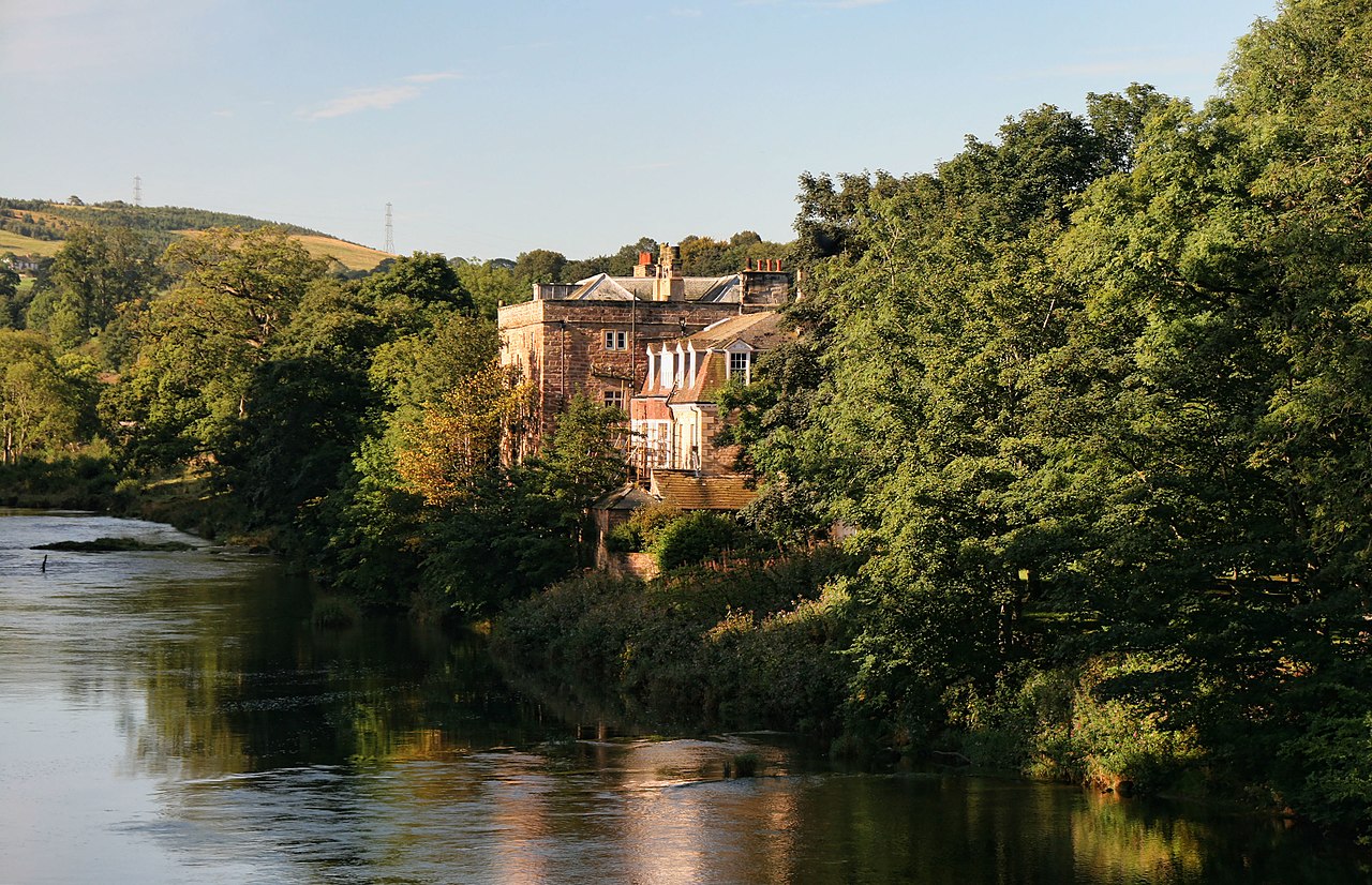
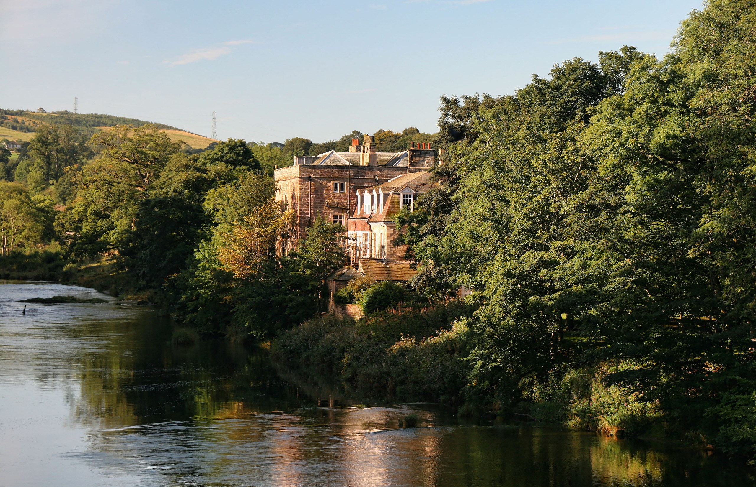
English: Armathwaite Castle. View from Armathwaite Bridge looking up the River Eden to Armathwaite Castle. |
| Date | |
| Source | From geograph.org.uk; transferred by User:France3470 using geograph_org2commons. |
| Author | Peter McDermott |
| Permission (Reusing this file) |
Creative Commons Attribution Share-alike license 2.0 |
| Attribution (required by the license) | Peter McDermott / Armathwaite Castle / |
| Camera location | | View this and other nearby images on: OpenStreetMap |
|---|
| Object location | | View this and other nearby images on: OpenStreetMap |
|---|
_region:GB-GBN_heading:225.00&language=en)
Licensing

|
This image was taken from the Geograph project collection. See this photograph's page on the Geograph website for the photographer's contact details. The copyright on this image is owned by Peter McDermott and is licensed for reuse under the Creative Commons Attribution-ShareAlike 2.0 license.
|
This file is licensed under the Creative Commons Attribution-Share Alike 2.0 Generic license.
Attribution: Peter McDermott
- You are free:
- to share – to copy, distribute and transmit the work
- to remix – to adapt the work
- Under the following conditions:
- attribution – You must give appropriate credit, provide a link to the license, and indicate if changes were made. You may do so in any reasonable manner, but not in any way that suggests the licensor endorses you or your use.
- share alike – If you remix, transform, or build upon the material, you must distribute your contributions under the same or compatible license as the original.
File history
Click on a date/time to view the file as it appeared at that time.
| Date/Time | Thumbnail | Dimensions | User | Comment | |
|---|---|---|---|---|---|
| current | 19:08, 22 March 2012 | | 3,853 × 2,486 (1.69 MB) | commons>File Upload Bot (Magnus Manske) |
File usage
There are no pages that use this file.