File:Ancient tamilakam ports.png
Jump to navigation
Jump to search
Size of this preview: 607 × 600 pixels. Other resolutions: 243 × 240 pixels | 486 × 480 pixels | 777 × 768 pixels | 1,036 × 1,024 pixels | 2,073 × 2,048 pixels | 4,984 × 4,925 pixels.
Original file (4,984 × 4,925 pixels, file size: 9 MB, MIME type: image/png)
Summary
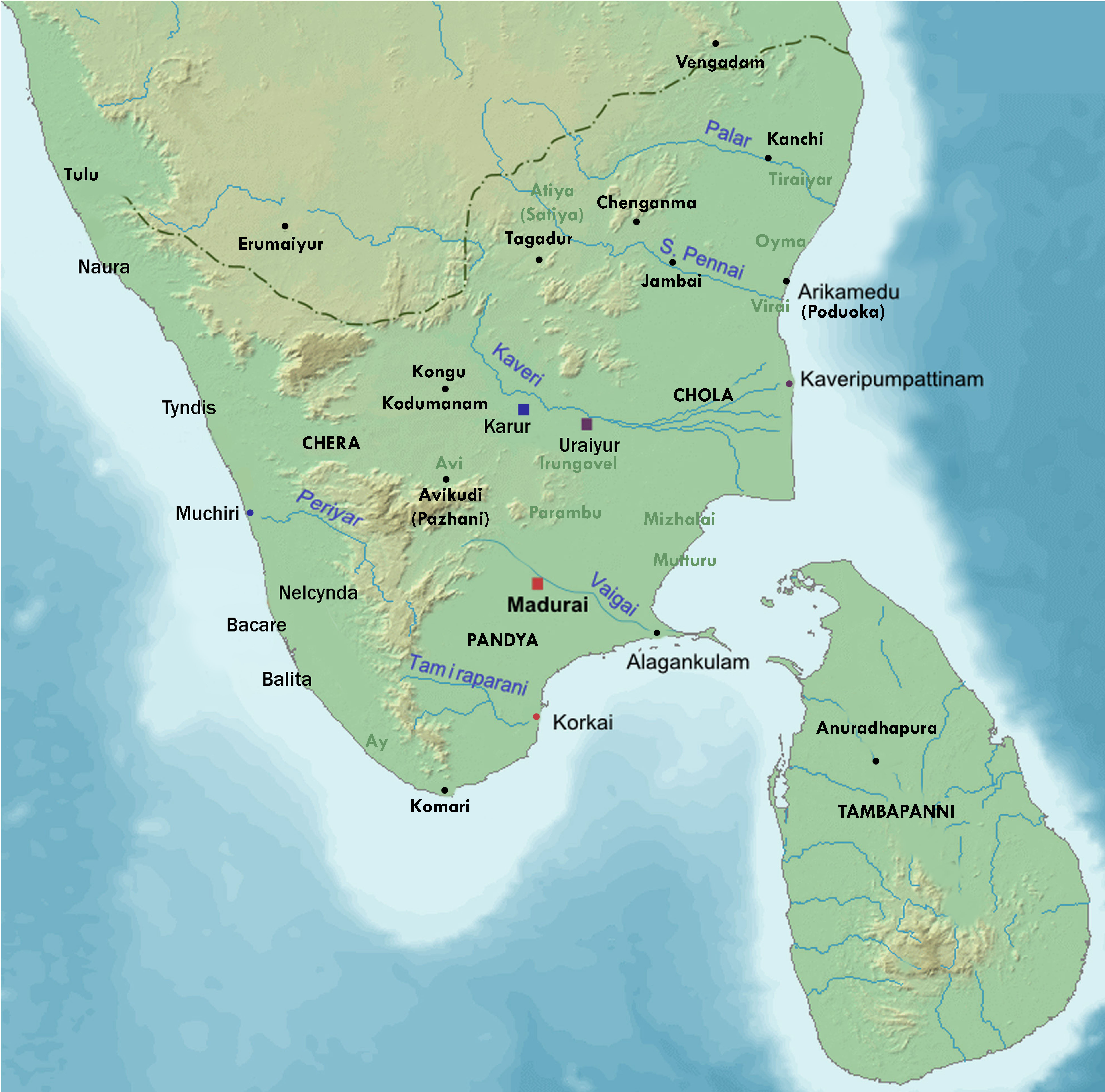
| Description | Map showing the important port cities of ancient Tamil country and its approximate northern boundary |
| Date | |
| Source |
Source of map: http://www2.demis.nl/mapserver/mapper.asp (mention : "Disclaimer: With this statement DEMIS BV grants you permission to freely copy the PNG images returned by our server and use them for your own purposes, including web pages. We would appreciate a reference to our server but such a reference is not required, nor do we take responsibility for the accuracy or quality of the maps". at http://www2.demis.nl/mapserver/DataSrc.htm) Modified by me using Inkscape. |
| Author | Lotlil |
Licensing
| This work has been released into the public domain by its author, I, Lotlil. This applies worldwide. In some countries this may not be legally possible; if so: I, Lotlil grants anyone the right to use this work for any purpose, without any conditions, unless such conditions are required by law. |
File history
Click on a date/time to view the file as it appeared at that time.
| Date/Time | Thumbnail | Dimensions | User | Comment | |
|---|---|---|---|---|---|
| current | 07:24, 29 November 2019 | | 4,984 × 4,925 (9 MB) | commons>StephenPaa | Added more locations |
File usage
There are no pages that use this file.