File:Amtrak Northeast Regional.svg
Jump to navigation
Jump to search

Size of this PNG preview of this SVG file: 796 × 600 pixels. Other resolutions: 319 × 240 pixels | 637 × 480 pixels | 1,020 × 768 pixels | 1,280 × 964 pixels | 2,560 × 1,928 pixels | 1,301 × 980 pixels.
Original file (SVG file, nominally 1,301 × 980 pixels, file size: 1.15 MB)
Summary
| Description |
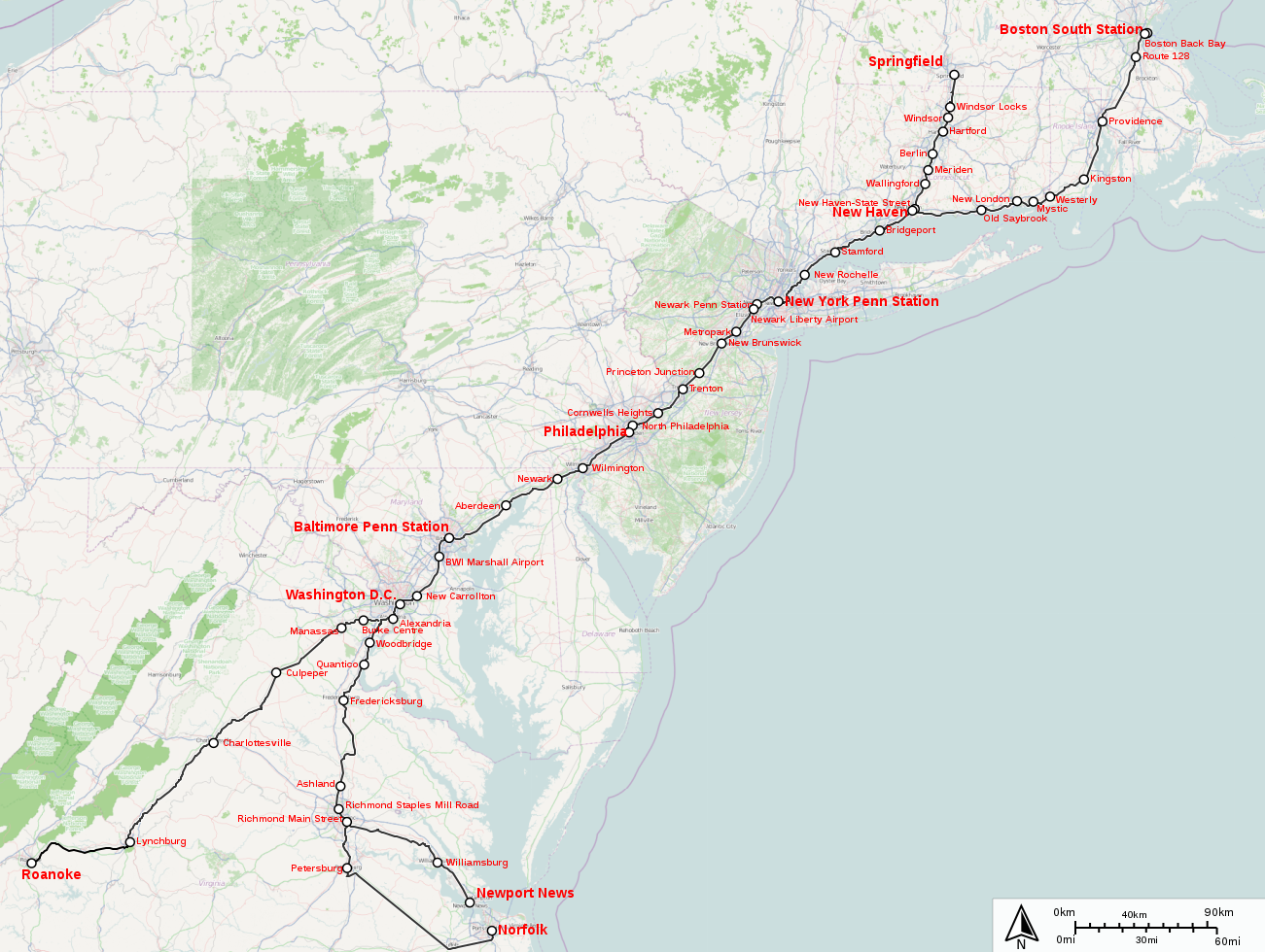
English: Amtrak Northeast Regional
Legend:
|
| Date | |
| Source |
http://sharemap.org/public/Amtrak_Northeast_Regional Geospatial data sources:
|
| Author | Jkan997 |
| SVG development |

Thumbnail with colored legend in caption

[[File:Amtrak_Northeast_Regional.svg|thumb|<center>Amtrak Northeast Regional {{nowrap|([[ShareMap:public/Amtrak_Northeast_Regional|interactive map]])}}]]
Licensing
This file is licensed under the Creative Commons Attribution-Share Alike 3.0 Unported license.
- You are free:
- to share – to copy, distribute and transmit the work
- to remix – to adapt the work
- Under the following conditions:
- attribution – You must give appropriate credit, provide a link to the license, and indicate if changes were made. You may do so in any reasonable manner, but not in any way that suggests the licensor endorses you or your use.
- share alike – If you remix, transform, or build upon the material, you must distribute your contributions under the same or compatible license as the original.
File history
Click on a date/time to view the file as it appeared at that time.
| Date/Time | Thumbnail | Dimensions | User | Comment | |
|---|---|---|---|---|---|
| current | 17:37, 7 March 2019 | | 1,301 × 980 (1.15 MB) | commons>PrecipiceofDuck | Updated to add station stop at New Haven-State Street for trains to/from Springfield, and minor realignment of text. |
File usage
There are no pages that use this file.