File:Alsace Lorraine departments evolution map-en.svg
Jump to navigation
Jump to search

Size of this PNG preview of this SVG file: 600 × 450 pixels. Other resolutions: 320 × 240 pixels | 640 × 480 pixels | 1,024 × 768 pixels | 1,280 × 960 pixels | 2,560 × 1,920 pixels.
Original file (SVG file, nominally 600 × 450 pixels, file size: 91 KB)
File history
Click on a date/time to view the file as it appeared at that time.
| Date/Time | Thumbnail | Dimensions | User | Comment | |
|---|---|---|---|---|---|
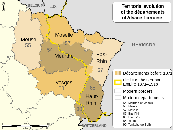
| current | 19:47, 27 August 2011 | | 600 × 450 (91 KB) | commons>OwenBlacker | == {{int:filedesc}} == {{Information |Description={{Multilingual description |en= Changes of the boundaries of departments in Alsace and Lorraine before and after the German Empire's rule (1871-1918). |fr= Év |
File usage
There are no pages that use this file.