File:Alger geographie.png
Jump to navigation
Jump to search
Size of this preview: 800 × 368 pixels. Other resolutions: 320 × 147 pixels | 640 × 295 pixels | 1,024 × 472 pixels | 1,913 × 881 pixels.
Original file (1,913 × 881 pixels, file size: 1.23 MB, MIME type: image/png)
File history
Click on a date/time to view the file as it appeared at that time.
| Date/Time | Thumbnail | Dimensions | User | Comment | |
|---|---|---|---|---|---|
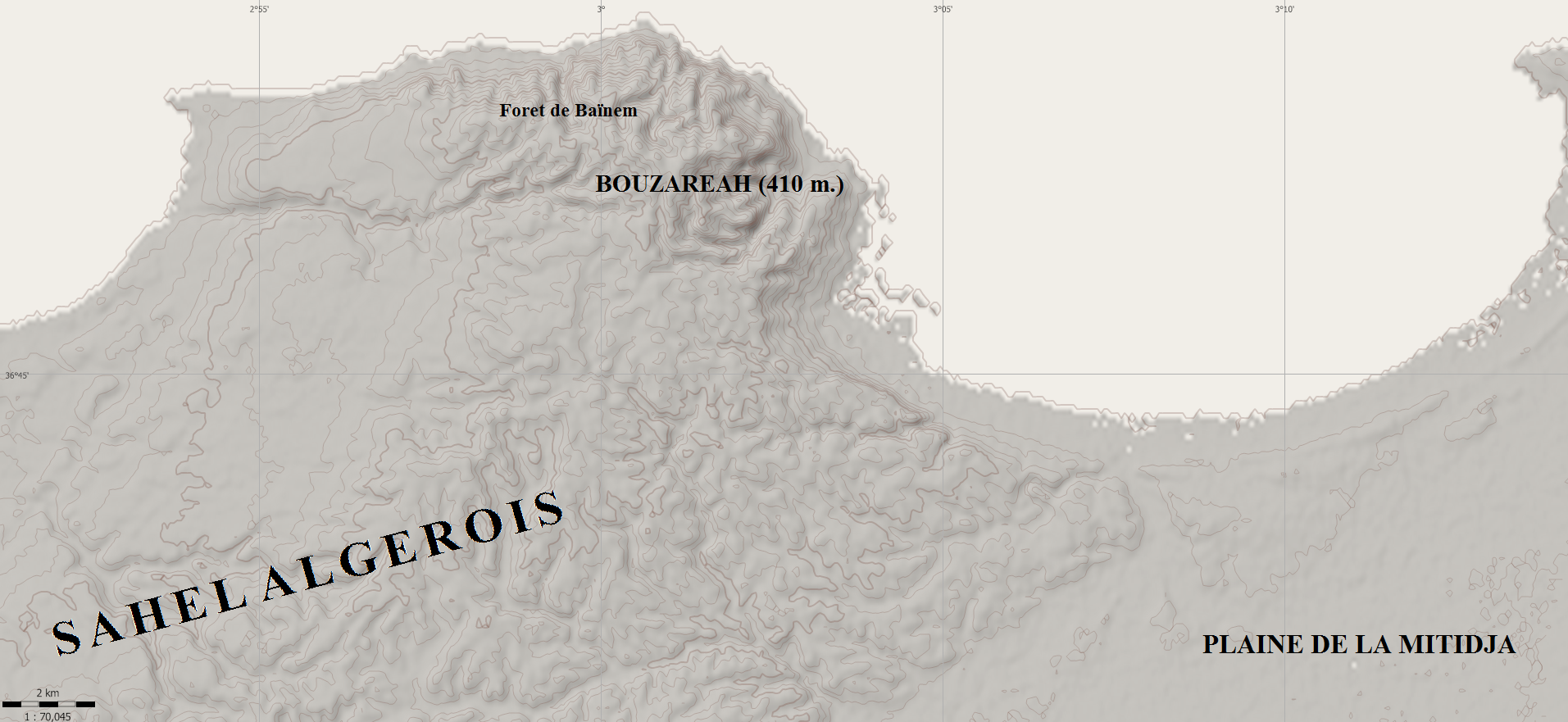
| current | 01:55, 5 February 2011 | | 1,913 × 881 (1.23 MB) | commons>Sandervalya | {{Information |Description ={{en|1=Relief of Algiers area}} {{fr|1=Relief de la région d'Alger}} |Source ={{own}} avec Maperitive |Author =Sandervalya |Date =2010-02-05 |Permission = |other_versions = |
File usage
There are no pages that use this file.