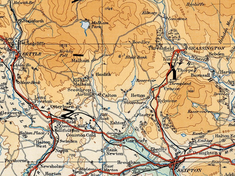
File:Airedale 1922 OS Map.png
Jump to navigation
Jump to search

Size of this preview: 800 × 600 pixels. Other resolutions: 320 × 240 pixels | 640 × 480 pixels | 1,024 × 768 pixels | 1,200 × 900 pixels.
Original file (1,200 × 900 pixels, file size: 2.53 MB, MIME type: image/png)
File history
Click on a date/time to view the file as it appeared at that time.
| Date/Time | Thumbnail | Dimensions | User | Comment | |
|---|---|---|---|---|---|
| current | 13:54, 21 August 2008 | | 1,200 × 900 (2.53 MB) | commons>JD554 | {{Information |Description=Map of the Airedale area taken from the 1922 Ordnance Survey Atlas of England and Wales |Source=http://www.guillemotdesign.org/maps/images/folio4left_300.jpg |Date=1922 |Author=JD554 |Permission=see below |other_versions= }} == |
File usage
There are no pages that use this file.