File:Aguilar-de-la-Frontera-mapa.png
Jump to navigation
Jump to search
No higher resolution available.
Aguilar-de-la-Frontera-mapa.png (251 × 312 pixels, file size: 22 KB, MIME type: image/png)
Summary
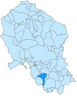
| Description | Mapa de Aguilar de la Frontera en la provincia de Córdoba, Andalucía, España. |
| Date | |
| Source | Own work |
| Author | Américo Toledano |
| Permission (Reusing this file) |
del autor |
Licensing
| I, the copyright holder of this work, release this work into the public domain. This applies worldwide. In some countries this may not be legally possible; if so: I grant anyone the right to use this work for any purpose, without any conditions, unless such conditions are required by law. |
File history
Click on a date/time to view the file as it appeared at that time.
| Date/Time | Thumbnail | Dimensions | User | Comment | |
|---|---|---|---|---|---|
| current | 23:57, 18 April 2007 | | 251 × 312 (22 KB) | commons>Hameryko | {{Information |Description=Mapa de Aguilar de la Frontera en la provincia de Córdoba, Andalucía, España. |Source=trabajo propio |Date=09-02-2007 |Author=Hameryko |Permission=del autor |other_versions= }} [[Category:Maps of municipali |
File usage
There are no pages that use this file.