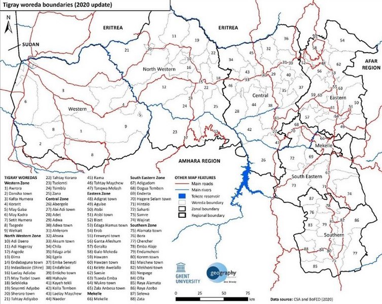
File:Administrative boundaries at woreda (district) level, as implemented in January 2020.jpg
Jump to navigation
Jump to search

Size of this preview: 753 × 599 pixels. Other resolutions: 302 × 240 pixels | 603 × 480 pixels | 770 × 613 pixels.
Original file (770 × 613 pixels, file size: 205 KB, MIME type: image/jpeg)
_level,_as_implemented_in_January_2020.jpg)
File history
Click on a date/time to view the file as it appeared at that time.
| Date/Time | Thumbnail | Dimensions | User | Comment | |
|---|---|---|---|---|---|
| current | 21:19, 28 June 2021 | | 770 × 613 (205 KB) | commons>Zoozaz1 | Uploaded a work by Sofie Annys, Tim Vanden Bempt, Emnet Negash, Lars De Sloover, and Jan Nyssen from https://www.researchgate.net/publication/349824181_Tigray_Atlas_of_the_humanitarian_situation with UploadWizard |
File usage
There are no pages that use this file.
_level,_as_implemented_in_January_2020.jpg)