File:Adelaide trammap 1950s.png
Jump to navigation
Jump to search
Size of this preview: 493 × 600 pixels. Other resolutions: 197 × 240 pixels | 394 × 480 pixels | 715 × 870 pixels.
Original file (715 × 870 pixels, file size: 138 KB, MIME type: image/png)
File history
Click on a date/time to view the file as it appeared at that time.
| Date/Time | Thumbnail | Dimensions | User | Comment | |
|---|---|---|---|---|---|
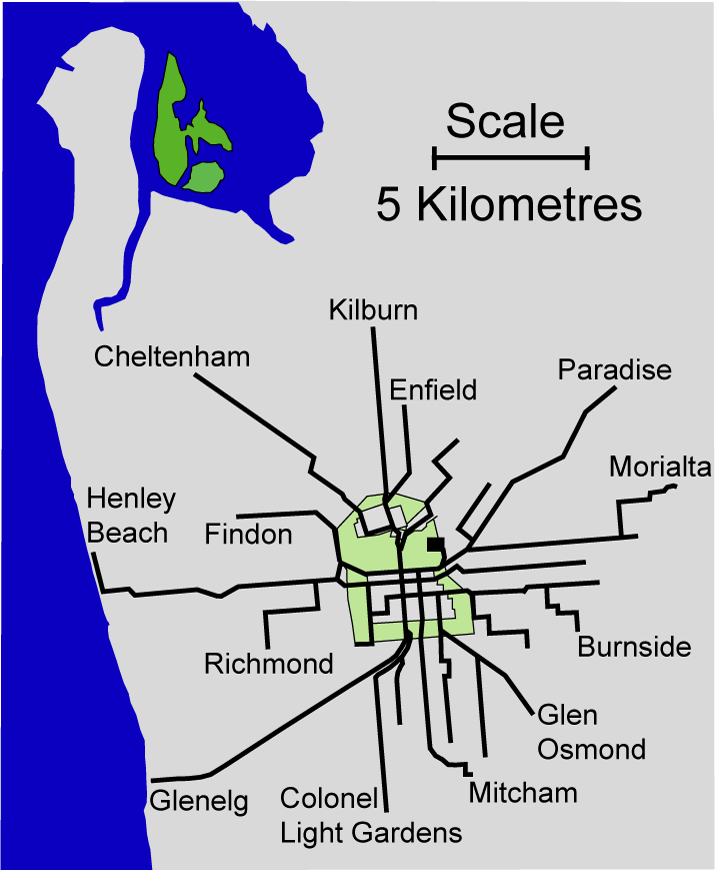
| current | 09:22, 18 February 2008 | | 715 × 870 (138 KB) | commons>Peripitus | == Summary == Map of the Adelaide electric tramlines at maximum extent (somewhere between 1952 and 1958). Self created from a 1952 MTT tram map and maps at the St Kilda tram museum Originally uploaded to en:wikipedia then re-uploaded here. Created by |
File usage
There are no pages that use this file.