File:1939 BRB&L map.png
Jump to navigation
Jump to search
Size of this preview: 800 × 462 pixels. Other resolutions: 320 × 185 pixels | 640 × 370 pixels | 1,024 × 592 pixels | 1,280 × 740 pixels | 3,500 × 2,023 pixels.
Original file (3,500 × 2,023 pixels, file size: 12.5 MB, MIME type: image/png)
File history
Click on a date/time to view the file as it appeared at that time.
| Date/Time | Thumbnail | Dimensions | User | Comment | |
|---|---|---|---|---|---|
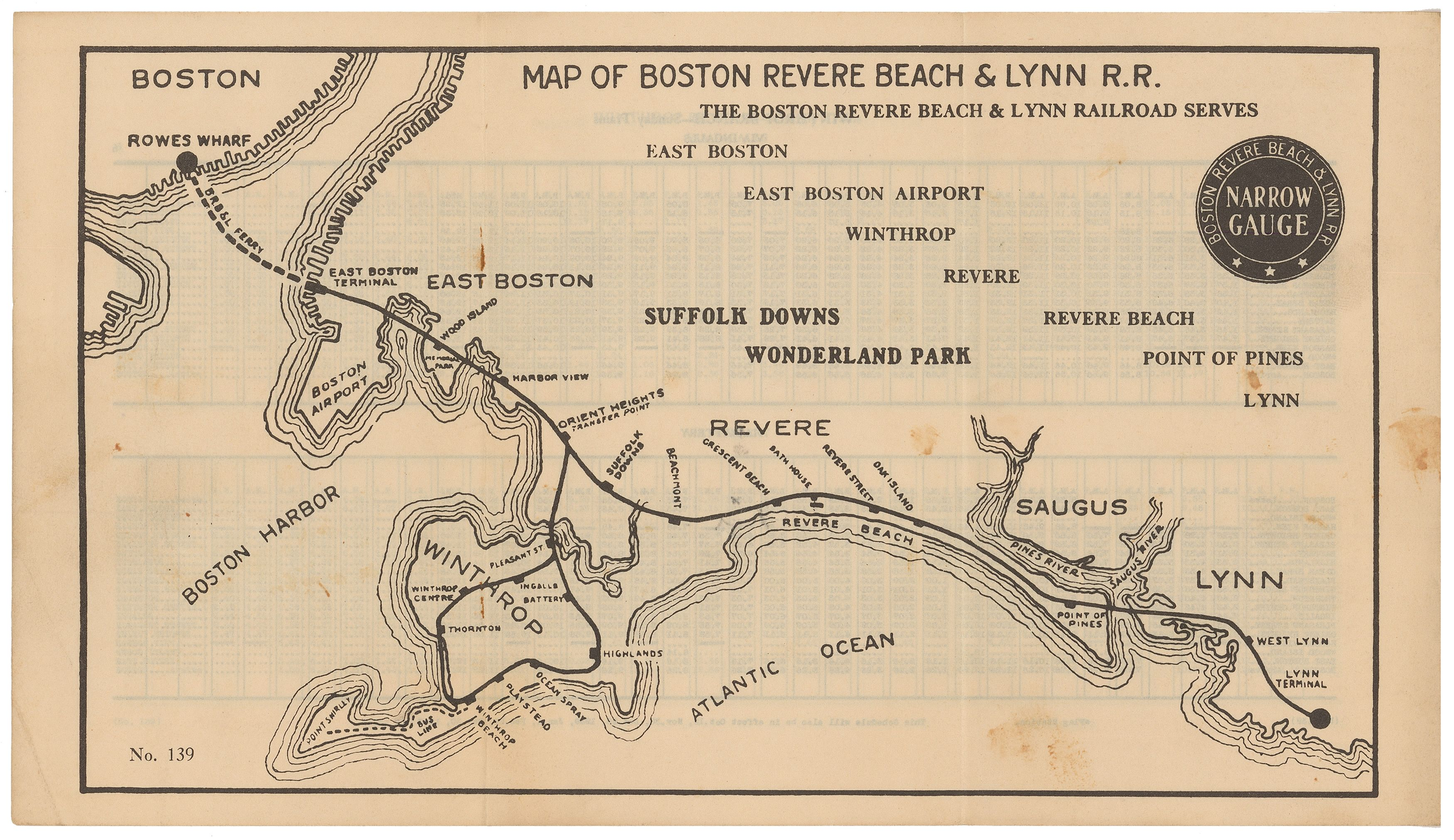
| current | 03:07, 20 May 2014 | | 3,500 × 2,023 (12.5 MB) | commons>Pi.1415926535 | {{Information |Description ={{en|1=1939 map of the Boston, Revere Beach and Lynn Railroad on the reverse of a timetable}} |Source =Scanned map available from [http://www.wardmaps.com/viewasset.php?aid=14046 WardMaps] |Author =Boston,... |
File usage
There are no pages that use this file.