File:1859 Pointe St-Charles.JPG
Jump to navigation
Jump to search

Size of this preview: 800 × 544 pixels. Other resolutions: 320 × 218 pixels | 640 × 436 pixels | 1,024 × 697 pixels | 1,280 × 871 pixels | 1,866 × 1,270 pixels.
Original file (1,866 × 1,270 pixels, file size: 537 KB, MIME type: image/jpeg)
File history
Click on a date/time to view the file as it appeared at that time.
| Date/Time | Thumbnail | Dimensions | User | Comment | |
|---|---|---|---|---|---|
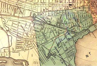
| current | 01:39, 5 October 2008 | | 1,866 × 1,270 (537 KB) | commons>Jeangagnon | {{Information |Description={{fr|1=Détail de la carte de Montréal de 1859 faisant ressortir Pointe Saint-Charles.}} |Source=http://www.imtl.org/image/cartes/1859/ |Author=F N Baxer, architect |Date=1859 |Permission= |other_versions= }} <!--{{ImageUpload |
File usage
There are no pages that use this file.