File:013 011 Havre St Pierre.jpg
Jump to navigation
Jump to search

Size of this preview: 800 × 530 pixels. Other resolutions: 320 × 212 pixels | 640 × 424 pixels | 1,024 × 678 pixels | 1,280 × 848 pixels | 2,560 × 1,696 pixels | 4,106 × 2,720 pixels.
Original file (4,106 × 2,720 pixels, file size: 4.2 MB, MIME type: image/jpeg)
Summary
| Description |
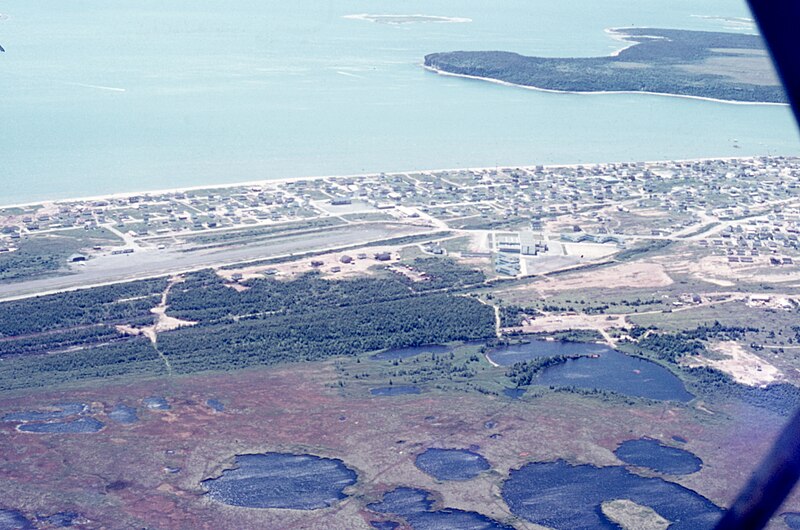
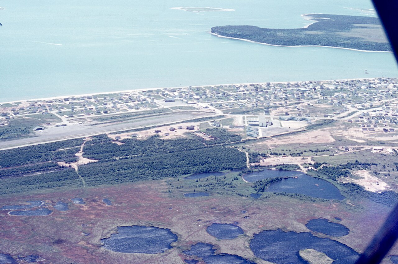
English: N 50° 15' 48" W 63° 32' 57", Côte-Nord, MRC Minganie, Havre-Saint-Pierre (Municipality), aboard an Air Saguenay seaplane, Lac des Plaines base (Lac d'Avion), Chemin lac des Plaines, Havre St-Pierre (Québec) G0G-1P0, Thursday, July 22, 1976, Manual geolocation, at the wharf.
Français : N 50° 15' 48" W 63° 32' 57", Côte-Nord, MRC Minganie, Havre-Saint-Pierre (Municipalité), à bord d’un hydravion d’Air Saguenay, base lac des Plaines (lac d’Avion), Chemin lac des Plaines, Havre St-Pierre (Québec) G0G-1P0, le jeudi 22 juillet 1976, Géolocalisation manuelle, au quai. |
| Date | |
| Source | Own work |
| Author | Nichole Ouellette |
| Camera location | | View this and other nearby images on: OpenStreetMap |
|---|
- More infos/photos, same author: ouellette001.com – Havre-Saint-Pierre
- Lac des Plaines, Air Saguenay Havre-Saint-Pierre 1976 Hydrobase 1976
- Installations portuaires, quai commercial, Havre-Saint-Pierre 2004
- Camping municipal, Rue Boréale Est
- Quai de la Société fer et titane du Québec Clocher de l'église, village
A seaplane flown by "Maringouin", a type from Drummondville, Air Saguenay, Havre-Saint-Pierre seaplane base, Lac des Plaines, known as Lac d'avion, on Thursday, July 22, 1976
Licensing
I, the copyright holder of this work, hereby publish it under the following license:
This file is licensed under the Creative Commons Attribution 4.0 International license.
- You are free:
- to share – to copy, distribute and transmit the work
- to remix – to adapt the work
- Under the following conditions:
- attribution – You must give appropriate credit, provide a link to the license, and indicate if changes were made. You may do so in any reasonable manner, but not in any way that suggests the licensor endorses you or your use.
File history
Click on a date/time to view the file as it appeared at that time.
| Date/Time | Thumbnail | Dimensions | User | Comment | |
|---|---|---|---|---|---|
| current | 10:28, 23 January 2024 | | 4,106 × 2,720 (4.2 MB) | commons>Nichole Ouellette | Uploaded own work with UploadWizard |
File usage
There are no pages that use this file.