Cyclone Lake
Jump to navigation
Jump to search
| Cyclone Lake | |
|---|---|
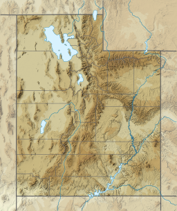
| Location | Garfield County, Utah |
| Coordinates | 37°59′00″N 111°43′08″W / 37.9832344°N 111.7190193°W |
| Type | lake |
| Surface elevation | 9,869 feet (3,008 m) |
Cyclone Lake is a lake in Garfield County, Utah, United States.[1] The lake is about 15 miles (24 km) north-northwest of Escalante and is located within the Dixie National Forest[2] with an elevation of 9,869 feet (3,008 m).[1]
Cyclone Lake was so named on account of the lake having been visited by a tornado (cyclone).[3]
References
- ^ a b U.S. Geological Survey Geographic Names Information System: Cyclone Lake
- ^ Cyclone Lake, Garfield County, UT, United States (Map). Trimble Navigation, Ltd. Retrieved 30 Mar 2016.
- ^ Cott, John W. Van (1990). Utah Place Names: A Comprehensive Guide to the Origins of Geographic Names : a Compilation. Salt Lake City: University of Utah Press. p. 99. ISBN 978-0-87480-345-7.
